
Climate Denton – TX
If you like the fact that you can understand the climate numbers in your area, this website will really help you!

REMEMBER YOUR ROOTS
If you like the fact that you can understand the climate numbers in your area, this website will really help you!

If you don’t think this is important, you should reconsider. This can guide you through plant species for certain areas, as much as how could you use the melting snow for irrigation…..boom! Climate maps – look for the drop down tab at the bottom left and explore info about snow, precipitation, cloud coverage, winds and …
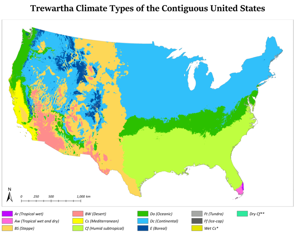
The Trewartha climate classification is a climate classification system first published by American geographer Glenn Thomas Trewartha in 1966. It is a modified version of the Köppen–Geiger system, created to answer some of its deficiencies. The Trewartha system attempts to redefine the middle latitudes to be closer to vegetation zoning and genetic climate systems. It was considered a more true or “real world” reflection of the …
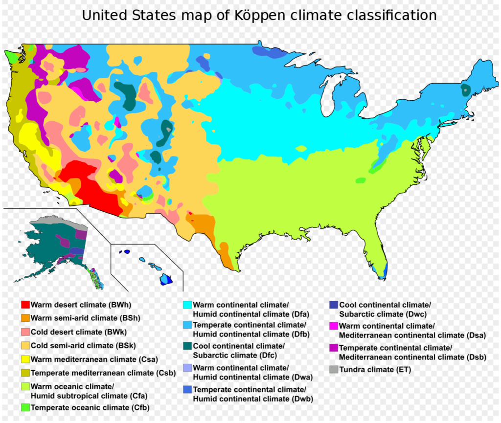
The system based on Wladmir Koppen’s experience as a botanist. His main climate groups are based on what types of vegetation grow in a given climate classification region. In addition to identifying climates, the system can be used to analyze ecosystem conditions and identify the main types of vegetation within climates. Did it lit a …

When planing a veggie garden for example, you have to be on top of your game and you don’t want to lose your crop cause you got by surprise with a frost…..very frustrating right? Knowing the average dates for frosts in your region will keep you on your toes and hopefully you will not waste …
Sun Solstice is crucial to understand if you wants to plant trees for example. Even when you are building a house you need to know how to position it properly, so you can use tree planting to your advantage as it shades over the house, or allows sun to come in, regulating indoor temperature and …

The National Weather Service website will give you data about not just current temperatures and climate, but also many more info such as; winds, snow, air quality, tides…….another tool that provides you with valuable information so you know exactly what your will be dealing with.
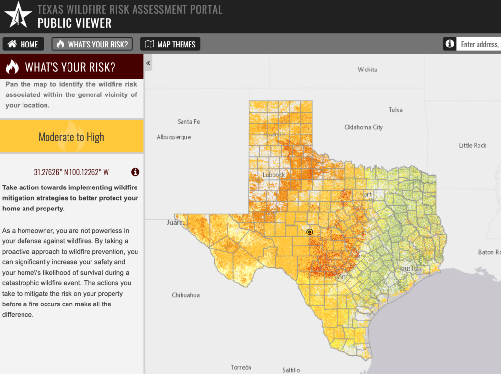
Knowing if you are in a high wildfire risk area is important so you can be safe and design always one step ahead of possible bumps in the road. If your are not in Texas, I suggest that you find a resource to find out that info,

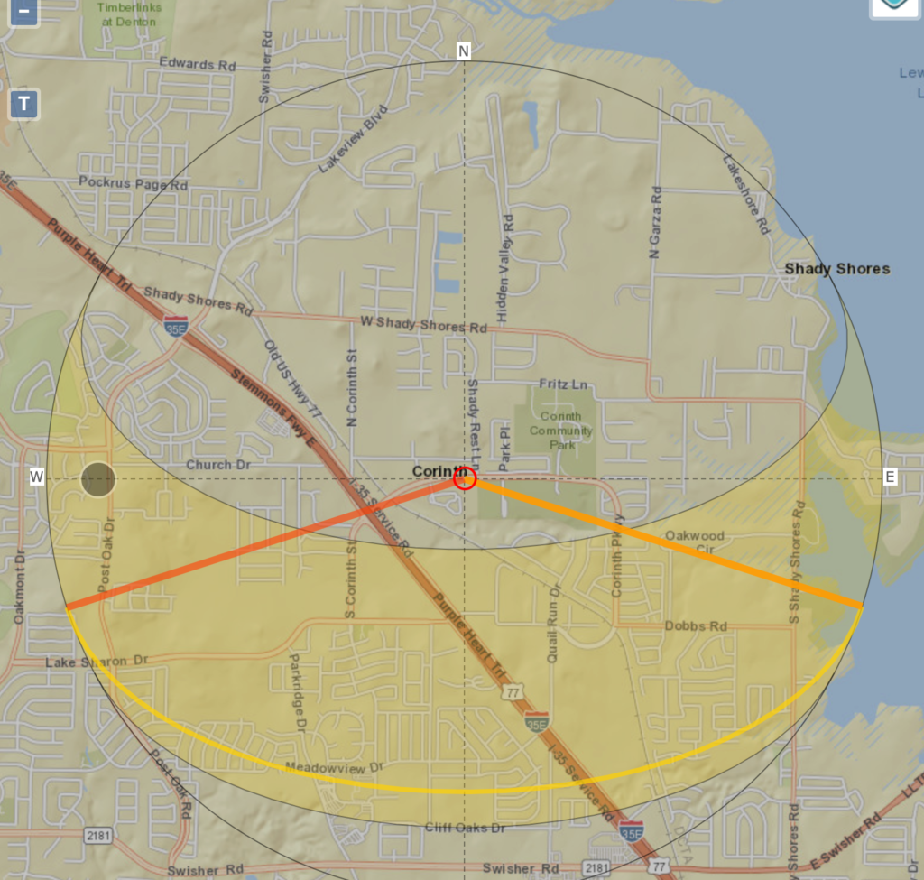
Another great website to find out where is your location at. Knowing where you are working surely makes a difference,

Here you can find the GPS coordinates, latitude, longitude and altitude of the desired site. Location will define many aspects in your design such as humidity, air pressure, native life, accesses and more.